How Burnt Lake Got Its Name

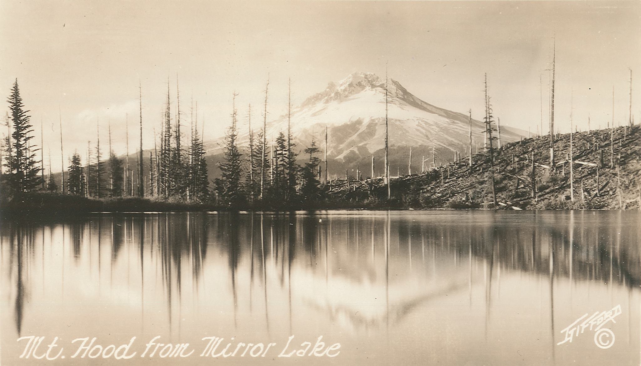
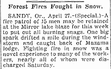
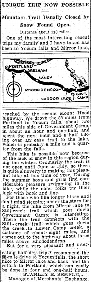
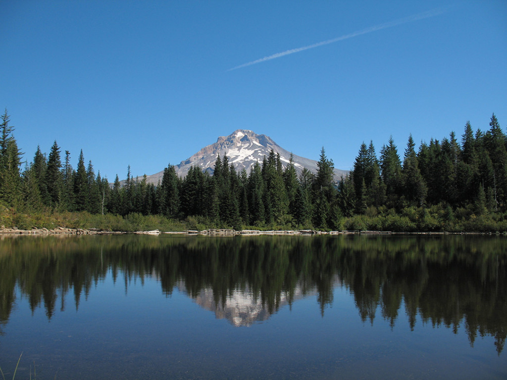
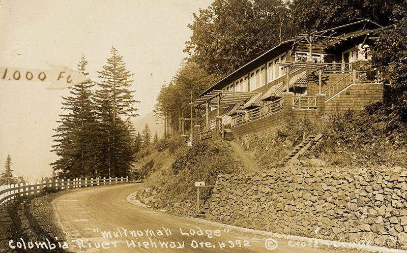
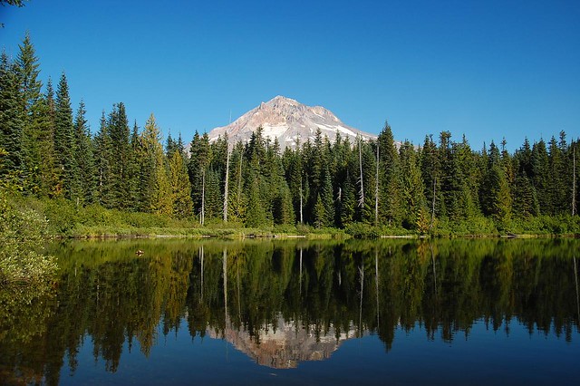
Burnt Lake is a six acre lake in the Mt. Hood Wilderness west of Mt. Hood. It is a very popular destination for both day hikers and backpackers since the hike in is only 3.5 miles one way. The fact that Mt. Hood serves as a beautiful backdrop to the lake certainly doesn’t hurt.

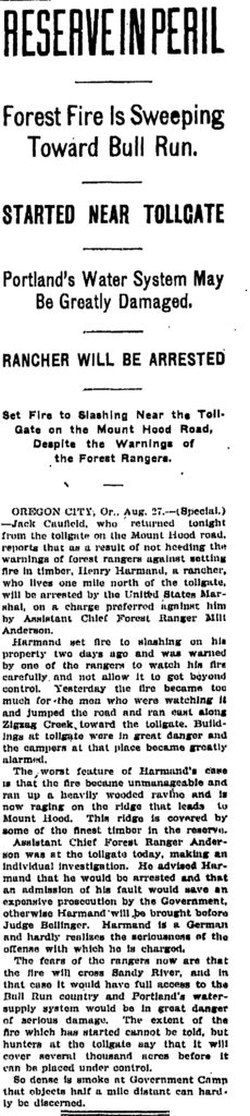
Looks pretty green, so how did it get its name? Turns out it wasn’t always green, and the name comes from when this area burned in an early 20th Century wildfire. An article in the August 28, 1904 edition of the Oregonian discusses a wildfire started by rancher Henry Harmand who lived “one mile north of the tollgate”. “Harmand set fire to slashing on his property two days ago and was warned by one of the rangers to watch his fire carefully and not allow it to get beyond control. Yesterday the fire became too much for the men who were watching it and jumped the road and ran east along Zigzag Creek, toward the tollgate.”

The article goes on to say “the extent of the fire which has started cannot be told, but hunters at the tollgate say that it will cover several thousand acres before it can be placed under control”. The smoke in Government Camp was so dense “that objects half a mile distant can hardly be discerned.”

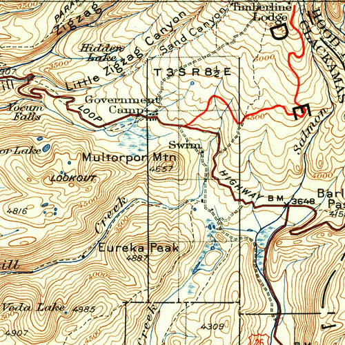
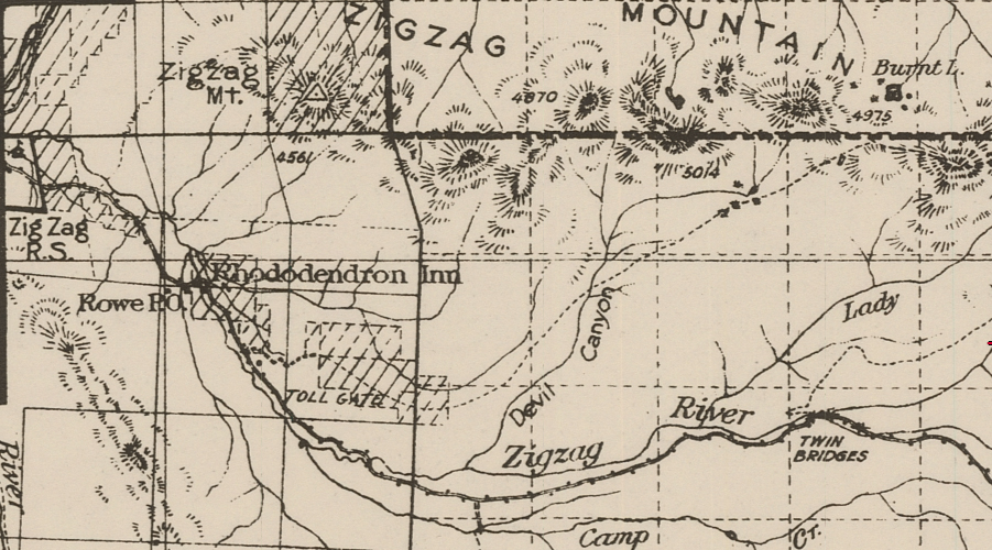
Here is a map of the area from the 1911 Mt. Hood National Forest map, showing Burnt Lake at upper right, Tollgate at lower left, and Zigzag Ranger Station at far left:

Unfortunately that is the last article about it. No more mention of Harmand or the fire. But additional information can be found in Hiking Mount Hood National Forest (2002), by Marcia Sinclair:

Ralph Lewis and John Cooper worked for the Forest Service in 1905. Twenty-three years old, they had grown up as children of the first homestreaders living around the mountain. Cooper Spur was named for John Cooper’s father who helped build the road up the mountain. Ralph and John named many landmarks in the country between Bull Run Lake and Zigzag Mountain. They knew every stream and rock outcrop. Their colorful story of the Clear Creek Fire was recorded when both men were elderly and is on file at Zigzag Ranger Station.

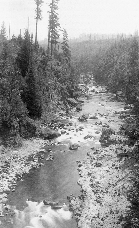
According to Ralph and John, in late August of 1906 a homesteader near Clear Creek was burning logs. He went out for a Sunday and left the fire burning. A west wind came up and “throwed it” across his fire lines into brush and dead timber. The fire became explosive. The ranger at Clear Fork “lost his head and put all his supplies in the creek and went for help.”

Gathering firefighters in 1906 was no small task. There were no roads through this country, only a few trails. There were no phones and people were spread out across miles of forest. As was the custom then, “winos” were rounded up on Burnside Street in Portland and brought by wagon to the mountain to fight fire.

While rangers tried to round up firefighters, the Clear Creek Fire spread from what is now McNeil Campground east across Old Maid Flat, up Zigzag Mountain and toward Lost Lake. Then the wind shifted. Blowing from the east, it took the fire back across its own path. According to Ralph and John it stopped at “green timber.”

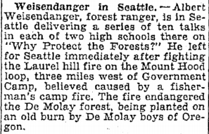
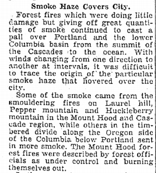
This wasn’t the first fire through here. A series of fires had swept across the south and west flanks of Mt. hood starting in 1902. It was in a 1904 blaze that Burnt Lake got its name. Even before these fires came through, the country was open enough that people traveled on foot or horseback through an open understory. The trail from Lost Lake to the Sandy River wasn’t built until 1903.

Indians used fire to maintain the plants they used most for food and medicine and sacred ceremonies. They regularly burned the forest late in the season, timing it so that the first fall rains would extinguish the blaze. This cleared shrubs and seedlings, but didn’t burn hot enough to kill the larger trees. According to Ralph, “It was said the Indians liked to see things burned off on account of hunting, and people to this day think that if the Indians was running things, instead of the Forest Service, we’d have less of these big fires.”

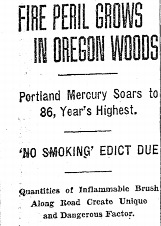
By the turn of the century, more people were using the forest for homesteading and recreation. As a result, fires became common during the hot summer months. A 1903 government report on forest conditions in the Cascade Range state, “These burns have taken place in all parts of the reserve, and so cannot be attributed to any particular cause, but rather demonstrate that wherever men go fires follow.”

By 1906, firefighting had become a Service. That year the rangers at Mt. Hood started posting lookouts. Ralph was one of the first. Thus began a hundred-year history of preventing and controlling forest fires.

I wonder if these two stories aren’t one in the same. Since Ralph and John were recounting their story many years later it’s possible that they got the year wrong and were referring to the fire mentioned in the 1904 article. I don’t see any mention of a “Clear Creek Fire” (or indeed any August wildfire near Mt. Hood) in the newspaper in 1906. In any case, a wildfire that swept through this area gave Burnt Lake its name.

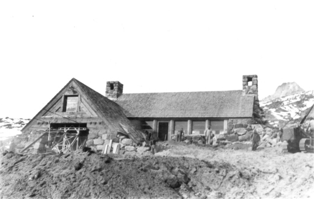
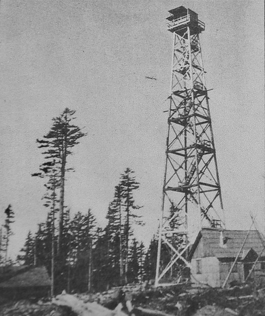
By the time the 1931 Mt. Hood National Forest map was printed a trail to Burnt Lake had been constructed. That map also shows the two lookouts on nearby Zigzag Mountain that were built sometime in the 1930s. The two spots became known as West Zigzag and East Zigzag. The L-4 ground cabin at West Zigzag was one of those unusual lookouts that was not on a peak with 360-degree views. It sat on a ridge with a view to the south. It is pictured here in this undated photo:

West Zigzag Lookout
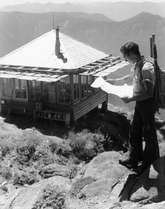
Photo credit: George Henderson

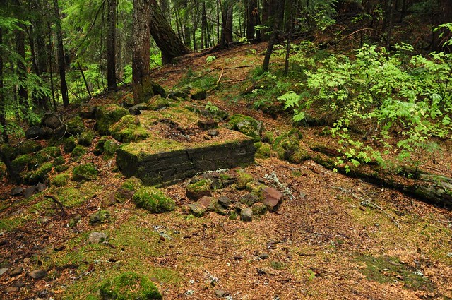
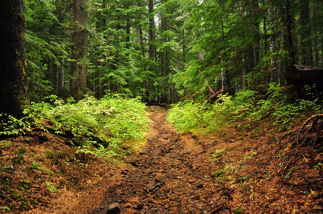
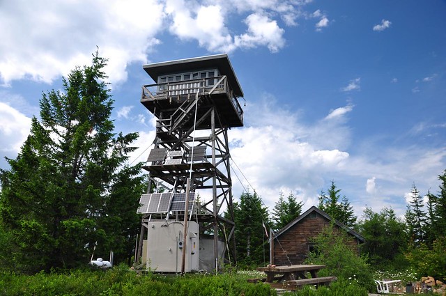
The lookout was removed in the 1960s, but you can still hike there. Here is roughly the same shot as the one above, in 2014:

West Zigzag Lookout site

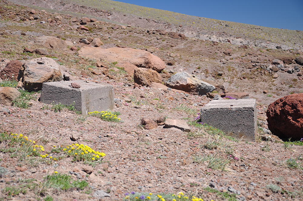
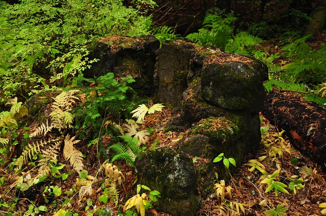
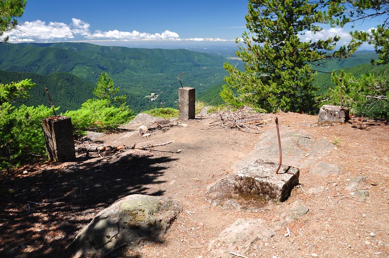
The footings are still there:

West Zigzag lookout site

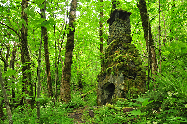
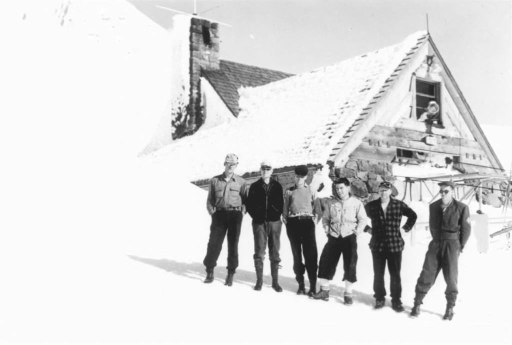
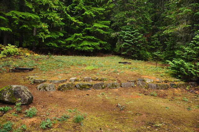
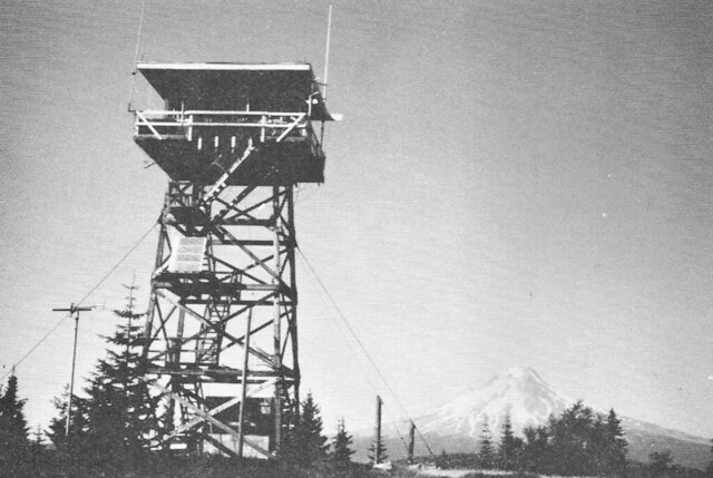
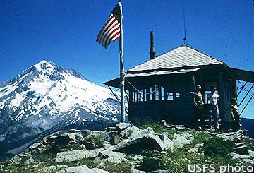
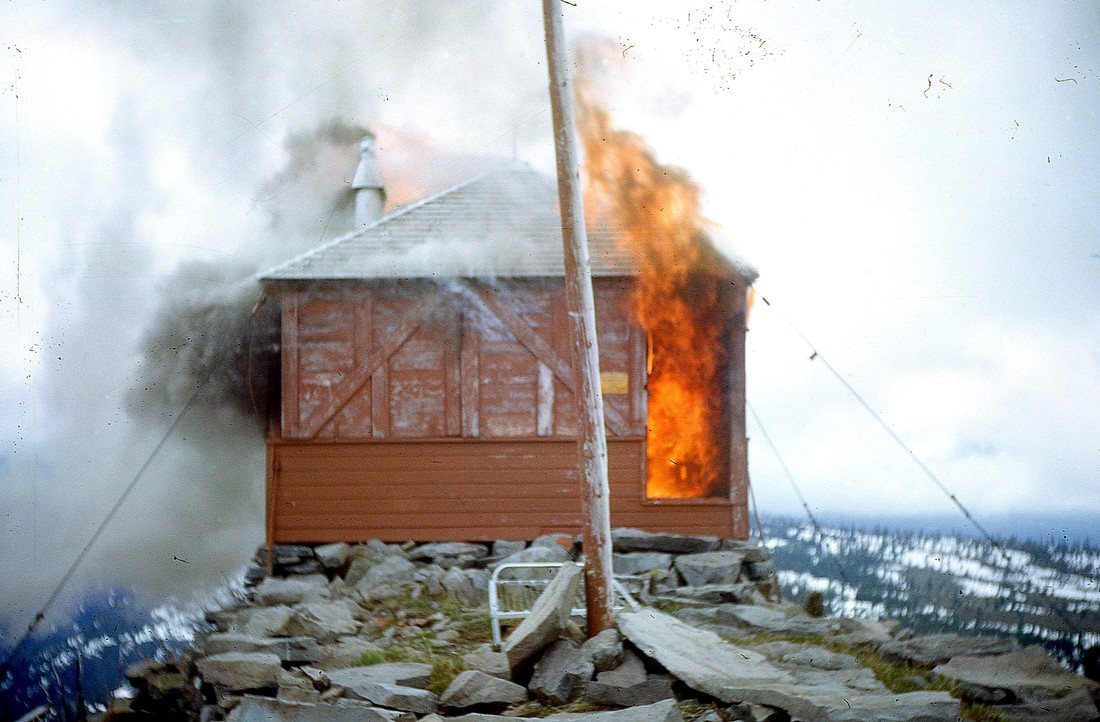
East Zigzag is right above Burnt Lake, and it also had an L-4 ground cabin, pictured here in 1953:

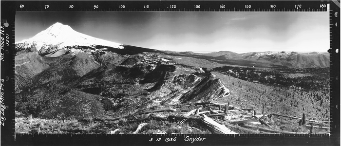
Panorama photos were taken in 1934 and you can see the effects of logging and fires on the surrounding forest:

The photo below is hanging in the Zigzag Ranger Station and didn’t have a date, but it looks to be from the 1960s based on that helicopter. This is a view looking west over Burnt Lake to East Zigzag, where the lookout still stands:

Burnt Lake
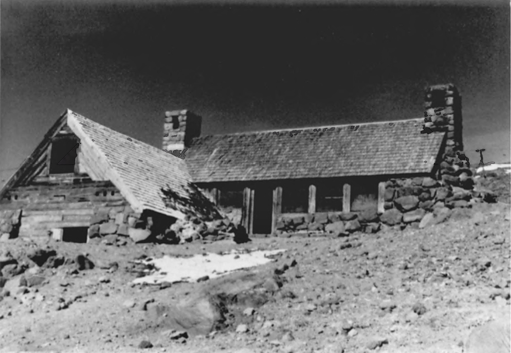
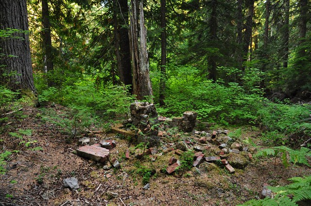
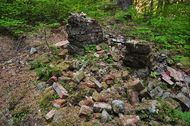
That lookout was removed by burning in the 1960s:

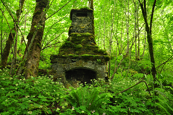
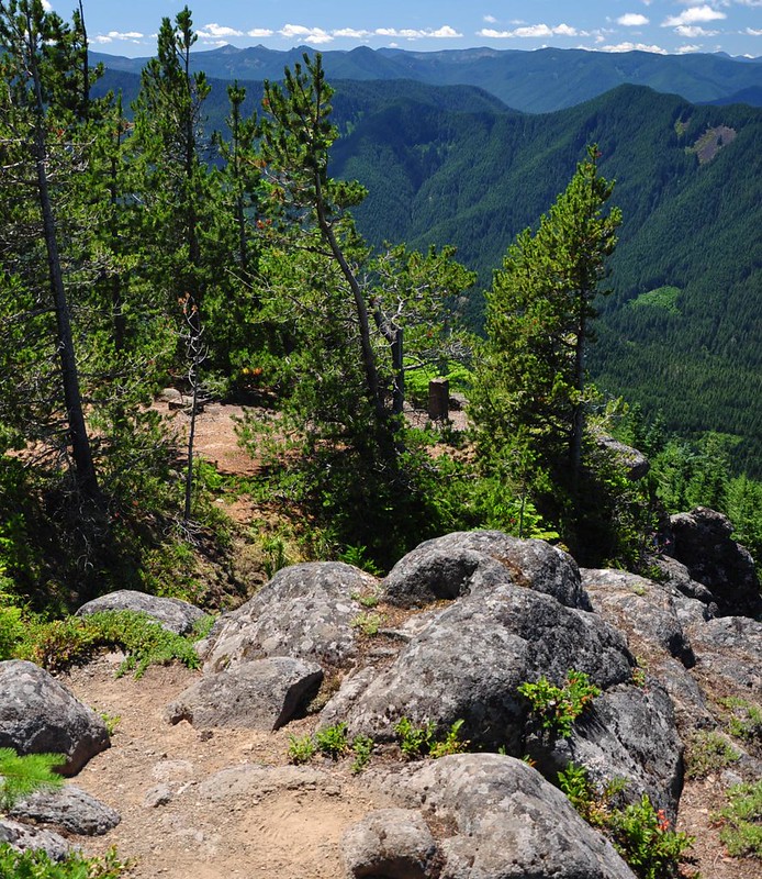
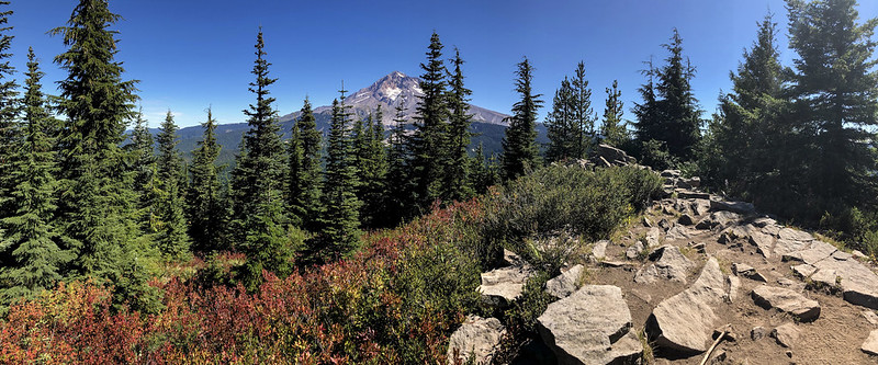
Hikers can still visit the spot by continuing past Burnt Lake or by hiking up from Devil’s Canyon, from a trailhead at the end of very rough Road 207. Here is what the site looked like in 2018:

East Zigzag

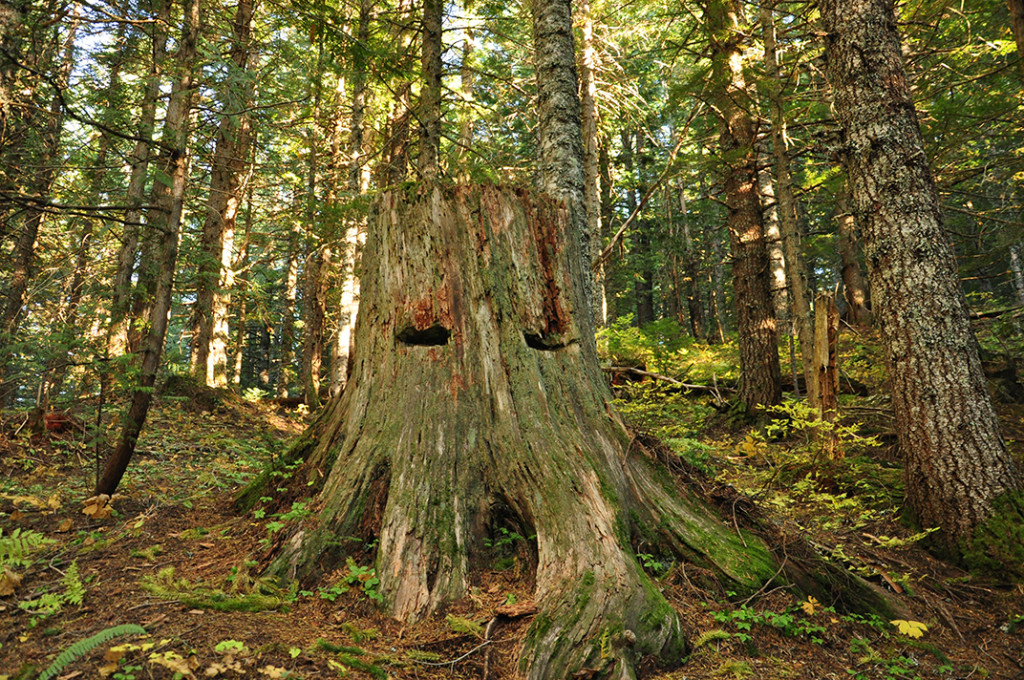
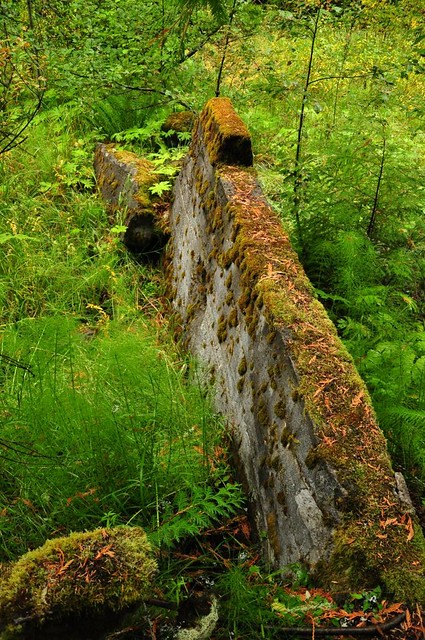
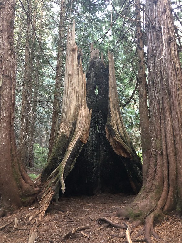
You can see some burnt-out cedar trees on the hike to Burnt Lake, presumably leftover from that long ago fire.

Burnt Cedar

As of 1964 this entire area – including Burnt Lake and Zigzag Mountain – is part of the Mt. Hood Wilderness.

Skiway Tram

Recreation in the Mt. Hood National Forest increased after the end of World War II. Skiing was a popular wintertime activity and Dr. J. Otto George envisioned a tramway connecting two popular skiing destinations: Government Camp and Timberline Lodge, which was 2,200′ higher up the mountain. He formed a corporation called the Mt. Hood Aerial Transportation and started looking for investors. In 1948 after he’d finally gathered enough money to get started and he’d gotten a conditional use permit to build on Forest Service land, clearing and logging of the 3.2-mile right-of-way began. After the right-of-way was cleared concrete was poured and the 38 steel towers were installed, along with 25 miles of 1.5-inch diameter cables.

Skiway_Tram2
The Skyway Tram

The tram was originally going to be called the “Skyway” but when they ran into copyright problems they changed it to “Skiway” (the tram buses were also nicknamed “cloudliners” AND “flying buses”). The tramway was promoted as the longest and largest in the world and the first of its type ever to be constructed. The tram cars were actually converted city buses and they each seated 36 people, with room for 14 more to stand. The tram did not operate like other trams did. The buses each had two 185-horsepower gas engines. A December 9, 1973 retrospective in the Oregonian described the mechanism:

Most mountain tramways are pulled by a moving cable. Not this one. The cars were suspended by sheaves from the 1.5-inch suspension cables. Two 1.75-inch cables wound around three-foot drive sheaves on the sides of the car. The cars pulled themselves up the mountain on the traction cables which were anchored at both ends.

Skiway_Tram1
The Skiway Tram
Skiway Terminal BW
The lower terminal of the Skiway Tram

After more than two years of construction, the tram was tentatively scheduled to opened in April 1950, but it wasn’t ready until early the following year. In advance of the grand opening, a promotional run on January 3, 1951 carried newsmen, radio announcers, and cameramen up the mountain. The January 4, 1951 Oregonian article – which called the tram the “Timberline Trolley” – reported that the trip took 20 minutes. Although the interior of the tram greatly resembled a city bus, the article said “the cloudliner makes considerably more noise than a wheeled bus. The clanking and grinding of its cables make conversation aboard impossible.” One reporter – who had been a WWII Air Corps officer – described riding in the back of the tram car “as similar to to the tail gunner’s spot in a B-17 bomber.” Riding in the front was like “riding the front end to a helicopter.” Finally, after more than three and a half years, on February 2 the newspaper reported that the tram would begin operating the next day. One-way fare was 75 cents; round-trip was $1.50. The lower terminal in Government Camp had a restaurant and snack bar operated by Thomas Johnson and his wife, who operated the restaurant at Multnomah Falls Lodge. The terminal also had a gift shop, ski shop, and guest lounge. The tram entered the terminal on the building’s third floor where the loading/unloading platforms were located.

The lower terminal can be seen at far right.
The lower terminal of the Skiway tram.

At Timberline Lodge the tram had no upper terminal building. Passengers had to load and unload from an open-air platform.

The loading platform at Timberline Lodge.

Improvements were planned almost immediately. Future plans included a bigger 500-space parking area, a new wing at the lower terminal to provide facilities for private parties, construction of an upper terminal building, and installing floodlights along the trail beneath the tram for night skiing and hiking. At a stockholders meeting in November 1952, it was suggested that the self-propelled buses be eliminated and be replaced by smaller, lighter coaches. The power plant would be on the ground (rather in each coach) so it would operate more like a ski lift does. The changes would increase the frequency of runs from once an hour to once ever 20 minutes. Nothing ever came of this plan, although the possibility of removing the buses and installing six-person gondolas was mentioned in the newspaper again in June 1956, at which point the two big self-propelled coaches had sat idle for the past six months due to dwindling ridership. Fare revenues had been $38,000 in 1952 but were down to $18,000 by 1954. The trams were slow and they only moved 72 passengers an hour. Plus, the new road to Timberline Lodge had opened the same year as the tram and when driving conditions were favorable the drive was a good 10 minutes less than the tram ride. The tram never reopened. During the summer of 1960 a salvage company removed the towers. One of the buses was scrapped and the other was bought by a logger in Seaside who used it as a toolshed. In January 1961 Franz Herrmann assumed management of the lower terminal. The Oregonian reported that he planned to “convert the building into a showplace” with plans to “remodel the lounge to provide a Swiss atmosphere. Within the next year or two he’ll convert the tram car loading area into 20 hotel rooms.” The lower terminal reopened in December 1962 as the Thunderhead Lodge with 21 private rooms, a coffee shop, deluxe dining room, and swimming pool. The entire ground floor was converted into a lounge and dance floor. On September 30, 1979 a small notice appeared in the Oregonian’s classified section that read: “Thunderhead Lodge on Mt. Hood at Government Camp being converted to 18 1 & 2 bdrm condominiums.” Today the condo building still stands and still bears the name Thunderhead Lodge.

Thunderhead Lodge in 2013.

If you hike up to the top of Tom, Dick, and Harry Mountain you can still see the path of the tramway between Government Camp and Timberline Lodge. It’s now called the Glade Trail and skiers use it to ski down the mountain in the winter

The old path of the tramway between Government Camp and Timberline Lodge.

Check out this 1956 video featuring the tram (and the untrue claim that it took only 10 minutes to ride to the top):

Mirror Lake

Oregon State Archives posted an historic photo of Mirror Lake on their Facebook page yesterday.

Historic photo of Mirror Lake
Undated photo of Mirror Lake (Oregon State Archives)

I thought at first that the denuded forest was the result of logging, but it might be because of a wildfire. A fire did hit the area in April of 1931. In the April 28, 1931 edition of The Oregonian, there were several separate mentions of a fire at Mirror Lake and at nearby Laurel Hill during an unusual spring heat wave:

04-28-1931d

04-28-1931

04-28-1931b

04-28-1931c


Whether before or after that fire (most likely before), this area was definitely heavily logged, and in fact if you hike up to Mirror Lake you can see huge stumps with the springboard notches in them.


Springboard logging on Larch Mountain in 1943 (USFS)


Old springboard notches along the Mirror Lake Trail in 2013

Mirror Lake has been a popular hiking destination for many years. The following write-up appeared in the March 11, 1934 edition of The Oregonian.

03-11-1934


Today Mirror Lake is one of the most popular hiking destinations in the Mt. Hood National Forest. The view has changed somewhat from the old postcard above since the trees have grown up quite a bit.


Mirror Lake in 2006

The Creation of the Mt. Hood National Forest

The forest surrounding Mt. Hood, Oregon’s tallest peak, is known as the Mt. Hood National Forest. But before it acquired that name it went through several decades of name changes.

By the 1890s people were growing concerned about the protection of public domain land in the western states. Section 24 of the Act of March 3, 1891 (which became known as the Forest Reserve Act) stated that

The president of the United States may, from time to time, set apart and reserve, in any State or Territory having public land bearing forests, in any part of the public lands wholly or in part covered with timber or undergrowth, whether of commercial value or not, as public reservations , and the President shall, by public proclamation, declare the establishment of reservations and the limits thereof.

The first use of this law in the Pacific Northwest resulted from the City of Portland’s desire to protect the Bull Run watershed, which served as the source the city’s drinking water. On June 17, 1892 President Benjamin Harrison signed into law Proclamation 332, Setting Apart as a Public Reservation Certain Lands in the State of Oregon. Under this new law the 142,080-acre Bull Run Reserve was set aside “reserved from entry or settlement and set apart as a public reservation.”

bullrunriver1894
The Bull Run River in 1894 (City of Portland Archives)

That was just the beginning. In February 1897, just before leaving office, President Grover Cleveland established 21 million acres of forest reserves. Setting aside land in this way was controversial. Timber barons, mine owners, and railroad companies wanted to do what they pleased with the land. Teddy Roosevelt, who became president in 1901, felt differently, saying “The forest reserves should be set apart forever for the use and benefit of our people as a whole and not sacrificed to the shortsighted greed of a few.” Roosevelt used his power to expand the forest reserves significantly.

On February 1, 1905 Congress passed the Transfer Act which transferred management of the forest reserves from the Department of the Interior to the Bureau of Forestry within the Department of Agriculture. On July 1, 1905 the Bureau of Forestry changed its name to the Forest Service. Gifford Pinchot, now in charge of 60 million acres of forest, was named Chief Forester. In 1907 the forest reserves were changed to national forests and the Bull Run Forest Reserve became the Bull Run National Forest on March 4, 1907.

On July 1, 1908 the Forest Service created the 1,787,280-million-acre Oregon National Forest. It consisted of the Bull Run National Forest and the northern part of the Cascade National Forest, with the Columbia River bordering on the north and the South Fork Santiam River on the south. (In 1911 the Santiam National Forest was created and the southern boundary of the Oregon National forest was moved north to the divide between the Santiam and Clackamas Rivers.)

oregonnationalforest
A group of snowshoers beneath an Oregon National Forest sign


Oregon National Forest map from 1916

The Forest Service adopted a policy to remove all state names from the names of forests. So on January 21, 1924 the forest underwent one final name change and became the Mt. Hood National Forest.

01-30-1924

Mist Falls Lodge

Multnomah Lodge was built along the Columbia River Highway near Mist Falls in 1916. It was one of several such establishments that sprang up along the newly-built highway that followed the southern shore of the Columbia River


Multnomah Lodge in 1917

When the lodge was put up for sale by the owners in 1919 a June 22 advertisement in the Oregonian listed the features of the place, including six guest rooms, three family rooms, and a dining room.

Sometime around 1920 the name was changed to Mist Falls Lodge. On July 31, 1921 the Oregonian ran an article extolling the virtues of a drive along the Columbia River Highway. Mist Falls Lodge was called “an attractive and cosy inn facing the highway, with its back to beautiful Mist Falls.”


Mist Falls Lodge as shown in the newspaper

In November of that year a severe snow and ice storm hit the Columbia River Gorge. The roof of the lodge collapsed under the weight. The pictures below appeared in the November 27 Oregonian.


The caption read: “Above–View of highway with wrecked Mist Falls Lodge at upper left. Below–One of scores of buried touring cars found along road.”

The roof was replaced and business carried on. A July 26, 1924 advertisement in the Oregonian touted the “delicious chicken dinners” as well as trails, swings, hammocks, music, refreshments, and fishing.

07-26-1924

The lodge was up for sale again in 1925, with a May 25 advertisement amusingly stating “Good proposition for some hustling woman.”

05-25-1925


Undated photo of Mist Falls Lodge (Ash Creek Images)

The lodge burned down in 1929 and was never rebuilt. In 1971 the site of the lodge was part of a five acre tract that was donated to the State Highway Commission by the landowners, Reuben and Rose Lenske. In a May 4, 1971 Oregon Journal article Reuben, who was strongly opposed to the Vietnam War, was quoted as saying “Instead of selling it and then devoting a considerable portion of the sales price to the federal government, in the wrongful destruction of the ecology and the environment as well as the people of a distant land,” he wanted instead to donate the land for “peaceful park purposes.”

The former site of the lodge is right along the Historic Columbia River Highway, although vegetation has grown up tremendously.


Mist Falls Lodge site in 2013


The plaque commemorating the 1971 land donation


A stone by the side of the road notes the year of construction


All that’s left of the lodge is the towering chimney

Former location of Mist Falls Lodge:


View Larger Map

Silcox Hut

Silcox Hut was built on the south side of Mt. Hood in 1939. Sitting at 6,950′ it is nearly 1,000 feet higher than Timberline Lodge, which opened to the public in 1938. Many of the WPA craftsmen who worked on Timberline Lodge also helped build Silcox Hut, which cost $58,000 to built.

silcox_hut_construction_1939
Silcox Hut under construction in 1939 (Oregon State Historic Preservation Office)

It was built in a non-intrusive style and was sunk into the mountainside to accomplish this. It was constructed from heavy timbers and native rock with walls four feet thick at the base and two feet thick where they join the roof. The building is shaped like an “L” and at its widest point is 60 feet long and 27 feet wide. The two chimneys are made from local stone. The hut was named after Ferdinand A. Silcox who was chief forester at the time that Timberline Lodge was being proposed and was a strong advocate for the project.

Ferdinand Silcox
Chief Forester Ferdinand Silcox (Forest History Society)

Silcox Hut served as the upper terminus of the Magic Mile chairlift, which was the second such lift ever built in the United States and the first to use steel towers. According to the National Register of Historic Places nomination form:

The lift began 200 yards east of Timberline Lodge, rose 996.5 feet in elevation over a 207° slope and ended 4,950 feet up the mountain at Silcox Hut. The lift had a capacity of 255 people per hour and moved at a rate of 450 feet per minute…To prevent skiers from falling out, each chair was supplied with a seat belt and blankets were provided to ward off the cold.

On May 21, 1939 Crown Prince Olav and Princess Martha of Norway secured the first tower with a nut and bolt in a pre-dedication ceremony. Oregon’s notoriously fickle spring weather made for a wet ceremony as described in the Oregonian the next day.

olav


The lift began operating on November 26, 1939 even though Silcox Hut was still two weeks from completion. When the hut did open it had a concession counter for the convenience of skiers.


Silcox Hut in 1939 (Oregon State Historic Preservation Office)

The lift operated in summer too, offering sunset rides with amazing views that a June 27, 1940 Oregonian article called “the finest in the west”.

The Magic Mile chairlift was moved in 1962 and Silcox Hut was left abandoned. Time, harsh weather, and especially vandals took their toll over the years. In a July 12, 1981 Oregonian article, Forest Service administrator Dick Hoffman said:

Climbers have torn down every stick of wood they could reach for firewood. We have restored the shakes (on the roof) twice, but it is a losing battle. We tried locking up the lounge area, leaving the bull wheel room open to provide emergency shelter for climbers. But someone managed to hack his way through a 3-inch wooden door and broke into the lounge wing. We barricaded the other doors and covered the windows with welded steel shutters, but vandals used bed frames to pry them off.


Silcox Hut in 1983 with roof damage (Oregon State Historic Preservation Office)

The hut was in bad shape and the Forest Service considered demolishing it. But it was listed on the National Register of Historic Places in 1984 and then Nancy Randall, a Portland attorney, founded the Friends of Silcox Hut and restoration efforts began. Hundreds of volunteers donated their time. Electrical outlets were installed without altering the stonework. Graffiti was planed out of the bar, which was made from a slab of 500-year-old Douglas-fir.

Finally in 1993 the restored hut reopened. Today Silcox Hut is run by Timberline Lodge and is available to rent for weddings and retreats. Strong hikers can walk up to it from Timberline Lodge via the service road.

The upper terminal of the relocated Magic Mile lift can be seen in the background below.

The door of the hut has an engraved sign on it.

The concrete footings from the old Magic Mile lift are still visible between the lodge and the hut.

Location of Silcox Hut:

Swim

The resort community of Swim was once located at the base of Multorpor Mountain near Government Camp. It was established sometime prior to 1924, when it appears on the USGS topo map.

Map of Swim area from 1924

A post office opened there in 1925, with resort owner Boyd Summers named postmaster. In 1928 two different advertisements ran in the Oregonian on June 15 and on August 10 listing the features and amenities of the resort, including fishing, hiking, campgrounds, a store, cabins, and “hot tub baths of radio active mineral water.”

Mount Hood Warm Mineral Springs Summer & Winter Resort Swimming Hiking Fishing Public Camping Grounds Completely furnished log cabins Store Post Office Gas & Oil Toboggan Slides Skiways Ski Jumps Hot Tub Baths of Radio Active Mineral Water Write for literature on home treatment of Radio Active Mineral remedy for Poison Oak, Rheumatism, Pyorrhea, High Blood Pressure, Cuts and many other ailments that Radio Active Springs will cure. Mr. and Mrs. Boyd Summers, Phone Swim, Ore Write Portland 57 mi Hood River 47 mi Mt. Hood Loop Highway

Swim Resort

Pool at Swim Resort
Pool at Swim Resort (sign on pole says “Swimming Pond Warm Mineral Water” and sign on building says “Mt. Hood Mineral Springs”) (U.S. Forest Service)

People were led to believe that the tubs at Swim Resort were fed by a hot spring. Since there is not a hot spring in the area many people now think that Summers heated the pool water artificially with a boiler hidden in the woods. In his book Lonely on the Mountain, George Henderson tells how he felt the creek water in 1936 and it wasn’t a bit warm, but he goes on to say that an “old-timer who had worked on the highway crew when the Barlow Road was realigned from Meldrum Meadows higher up the mountainside assured me that the creek had been warm before dynamite was used to install a culvert to carry the spring water under the new road.”

Pool at Swim Resort
Pool and cabin at Swim Resort (U.S. Forest Service)


Cabin at Swim Resort


Pool at Swim Resort (Mt. Hood Cultural Center & Museum)

Swimming pool at Swim Resort, Mt Hood National Forest
The Swim swimming pool (U.S. Forest Service)

415 Swimming pool at Swim Resort, Mt Hood National Forest
The Swim swimming pool (U.S. Forest Service)

175 Swim Resort near Summit Meadows Mt Hood
A postcard for Swim (U.S. Forest Service)

384 Swim resort, Mt Hood Nat'l Forest
A postcard for Swim (U.S. Forest Service)


Cover of brochure advertising Swim (Mt. Hood Cultural Center and Museum)


A group of winter visitors pose at the entrance to Swim

According to Jack Grauer in Mount Hood: A Complete History, drivers would park at what is now the Summit Ski Area at Government Camp and walk down the old Barlow Road which led right into Swim. In 1926 members of the recently-formed Cascade Ski Club moved tons of earth by hand to build a ski-jumping hill on the east side of Multorpor Mountain right above Swim. A November 22, 1927 article in The Oregonian noted that “a 1600-foot toboggan slide, a 1600-foot ski run, and a pretentious ski jump that will permit 180 to 200-foot ski jumps have been developed.” The Mount Hood Ski Club held it’s first annual tournament at Swim on Sunday, February 5, 1928, and a second annual tournament on February 10, 1929.


Map from a 1930 winter sports brochure published by the Forest Service (Mt. Hood Cultural Center and Museum)

On May 8, 1927, Boyd Summers’ personal cabin at the resort burned down. By the end of the summer of 1929 he had put the resort up for sale due to illness. This notice appeared in the August 30, 1929 edition of the Oregonian:

Swim Resort

On November 19, 1929 the Oregonian ran a short announcement that Ray L. Law and his brother Lewis M. Law had purchased the resort. The Law brothers apparently didn’t like running a mountain resort because on January 14, 1930, the day after a Cascade Ski Club tournament at the resort, the brothers took everything they could carry and skipped town. They had never paid Summers a dime.

In 1931 the resort was purchased by Edward J. Wonder from southern California. An  article in January of 1932 reported that Wonder planned to make improvements to the resort, including installing lights along the trail that led to Swim from Government Camp as well as along the ski run and toboggan slide, putting in a hydroelectric plant, installing two fish ponds, and building a new main lodge.

It’s unclear if these plans ever came to fruition. The Swim post office was decomissioned in 1932, probably because a new post office had just been established in nearby Government Camp in 1931. An Oregonian ad in 1935 indicated that the resort was still open for business.

Swim Resort

What happened after that is unknown, but at some point the resort closed and the buildings were torn down. Swim is shown on the 1938 Mt. Hood National Forest map, but not on the 1946 map. Henderson writes, “as the Depression deepened, the resort at Swim closed, and the swimming pool became part of a Forest Service campground.” The location of the Swim site today is near the Still Creek Campground in the middle of the forest. The passage of 70 years has almost entirely erased evidence that the resort ever existed. On a recent visit all I found was a pile of bricks on the east bank of Still Creek that were probably part of a fireplace.

DSC_0057

Swim Resort

10/13/12 Update: I returned to the area today. You can see more of the ruins by driving into the Still Creek Campground and parking at a small turn-out for a picnic area and exploring the area just beyond.


What appears to be an old hearth surrounded by stones from a collapsed chimney, possibly from one of the cabins

DSC_0142
The crumbling concrete walls of the old swimming pool

DSC_0171
This is right next to the old pool, so it might possibly the stone foundation of the bath house

DSC_0171
This looks like it might have been a fireplace

DSC_0161
If you walk up the trail from the picnic area you’ll be on the old Barlow Road where emigrants traveled with their wagons in the 1800s and where people walked down from Government Camp in the 1920s and 1930s on their way to Swim

The former location of Swim:

View Larger Map

Clear Lake Butte

Oregon used to have hundreds of fire lookouts perched on mountaintops. Every summer men and women were hired to live in or near these fire lookouts and spend their days watching out for forest fires. Eventually planes and satellites became a more efficient way of spotting fires, and today only a few fire lookouts remain. Some sit abandoned, some can be rented by members of the public for overnight stays, and some are still staffed in summer.

Clear Lake Butte is about 15 miles south of Mt. Hood. The Clackamas/Wasco county line goes right over the top of the butte. A 100 foot observation tower was constructed here in 1932. On a recent hike up to the butte, the woman staffing the current fire lookout showed me a picture of the original tower.

Clear Lake Butte
The original 1932 fire lookout on Clear Lake Butte

She also had pictures of a fallen tree that she had found while wandering around the summit. The tree had remains of ladder rungs along its length, which she supposed was leftover from a long-gone crow’s nest lookout at the top of the tree.

In the early years the person staffing the tower slept in a tent at the foot of the tower. A canvas fly covered a rough table, ice-box, and cookstove. In his book, Tales of High Clackamas Country, F. Alton Everest tells a story about Robin Hoodwink (not his real name) who briefly staffed the tower in 1934 before he was fired. One day Robin called down to the office.

“I’ve got a fire,” he yelled excitedly.
“Give me a bearing on it,” I said.
“No! No! I’ve got a fire right here. The grease in my frying pan caught fire and set the tarp on fire.”
“Well for the luva-mike, get off the phone and put it out before you start a forest fire.” Click. He hung up.
After about twenty minutes he phoned back. “Everything under control. I pulled the tarp down and beat the blaze out with a gunny sack.”

The first tower was replaced by a 41 foot wooden tower with an R-6 cab in 1962. The photo below shows this tower 30 years ago when the trees were shorter and you could see Mt. Hood from the ground.

Clear Lake Butte
Clear Lake Butte fire lookout, 1982 (Fire Lookouts of the Northwest, by Ray Kresek; photo by Ray Kresek)

That lookout still stands and is one of a few in the Mt. Hood National Forest that is staffed in summertime. These days the trees have gotten taller and there is no view of the mountain from the ground.

Clear Lake Butte
Clear Lake Butte fire lookout, 2012