The resort community of Swim was once located at the base of Multorpor Mountain near Government Camp. It was established sometime prior to 1924, when it appears on the USGS topo map.
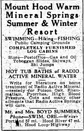
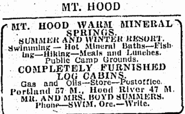
A post office opened there in 1925, with resort owner Boyd Summers named postmaster. In 1928 two different advertisements ran in the Oregonian on June 15 and on August 10 listing the features and amenities of the resort, including fishing, hiking, campgrounds, a store, cabins, and “hot tub baths of radio active mineral water.”
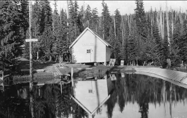
Pool at Swim Resort (sign on pole says “Swimming Pond Warm Mineral Water” and sign on building says “Mt. Hood Mineral Springs”) (U.S. Forest Service)
People were led to believe that the tubs at Swim Resort were fed by a hot spring. Since there is not a hot spring in the area many people now think that Summers heated the pool water artificially with a boiler hidden in the woods. In his book Lonely on the Mountain, George Henderson tells how he felt the creek water in 1936 and it wasn’t a bit warm, but he goes on to say that an “old-timer who had worked on the highway crew when the Barlow Road was realigned from Meldrum Meadows higher up the mountainside assured me that the creek had been warm before dynamite was used to install a culvert to carry the spring water under the new road.”
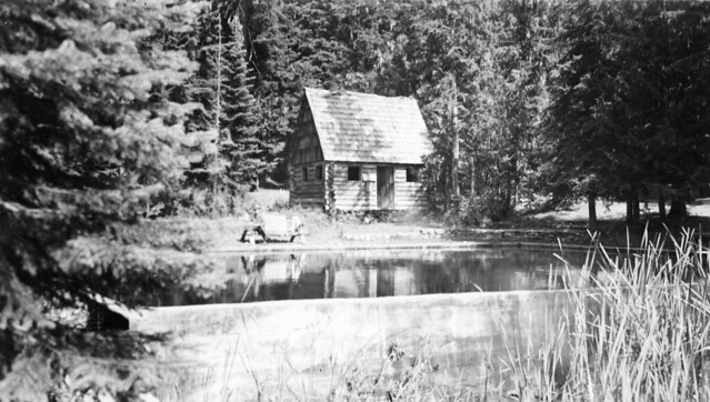
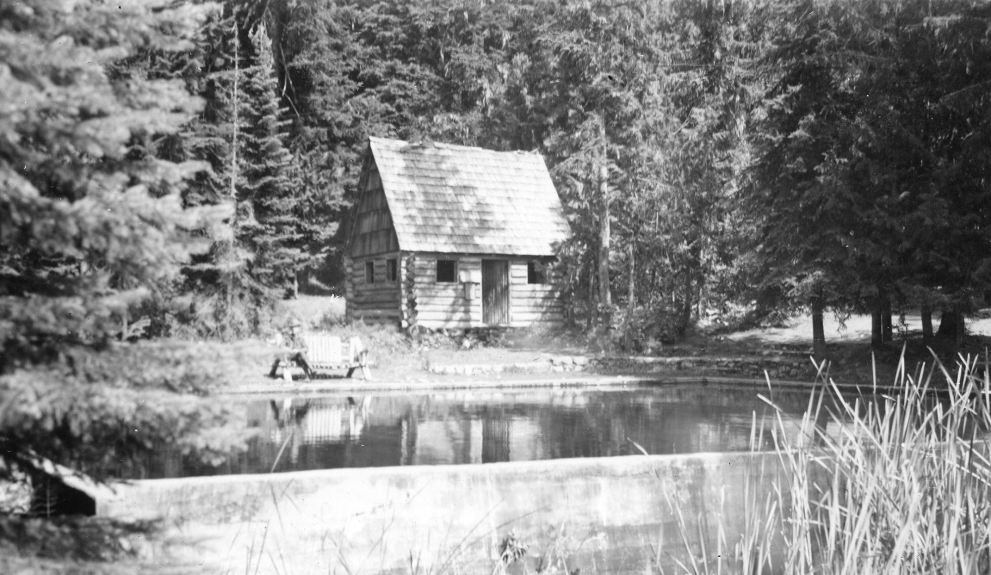
Pool and cabin at Swim Resort (U.S. Forest Service)
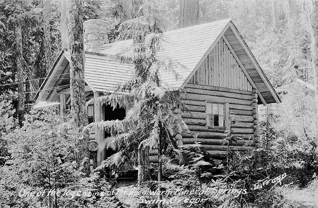
Cabin at Swim Resort
Pool at Swim Resort (Mt. Hood Cultural Center & Museum)
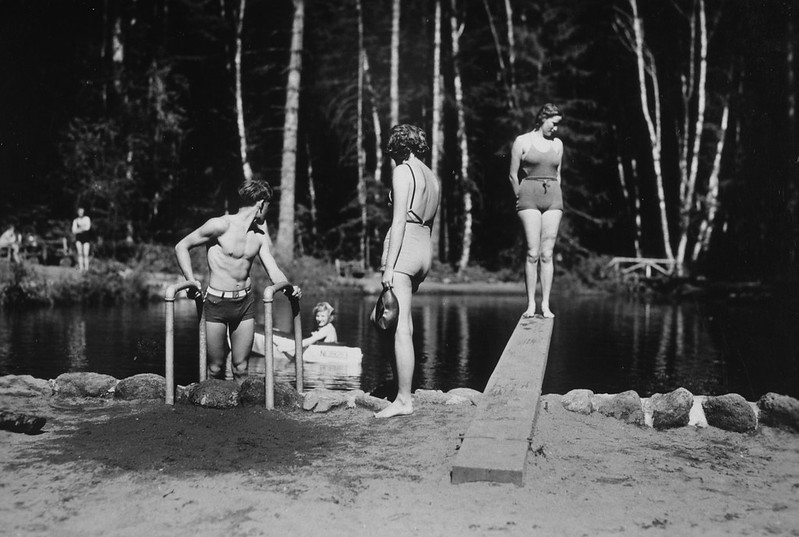
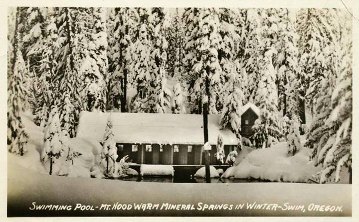
The Swim swimming pool (U.S. Forest Service)
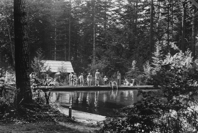
The Swim swimming pool (U.S. Forest Service)
A postcard for Swim (U.S. Forest Service)
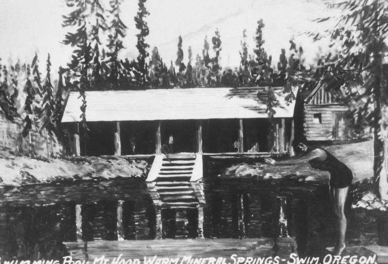
A postcard for Swim (U.S. Forest Service)

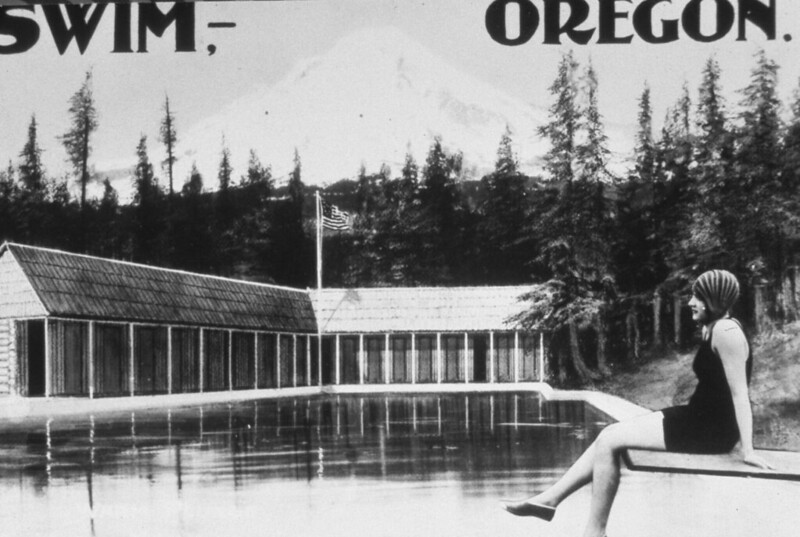
Cover of brochure advertising Swim (Mt. Hood Cultural Center and Museum)
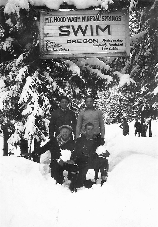
A group of winter visitors pose at the entrance to Swim
According to Jack Grauer in Mount Hood: A Complete History, drivers would park at what is now the Summit Ski Area at Government Camp and walk down the old Barlow Road which led right into Swim. In 1926 members of the recently-formed Cascade Ski Club moved tons of earth by hand to build a ski-jumping hill on the east side of Multorpor Mountain right above Swim. A November 22, 1927 article in The Oregonian noted that “a 1600-foot toboggan slide, a 1600-foot ski run, and a pretentious ski jump that will permit 180 to 200-foot ski jumps have been developed.” The Mount Hood Ski Club held it’s first annual tournament at Swim on Sunday, February 5, 1928, and a second annual tournament on February 10, 1929.
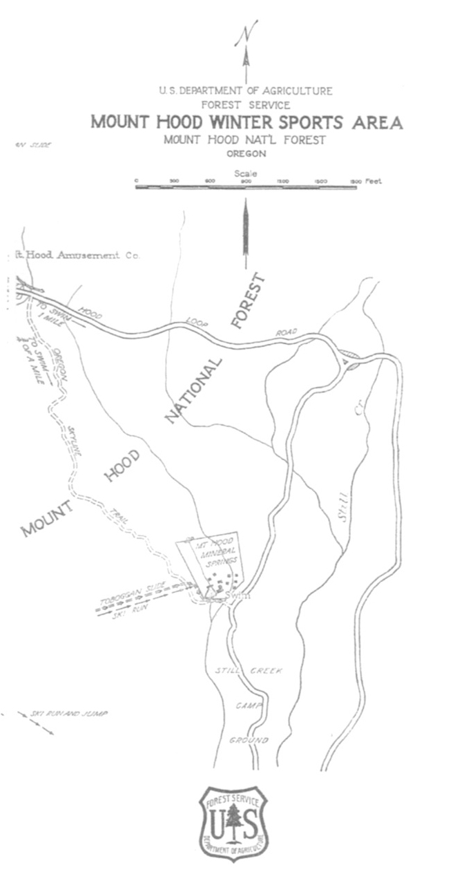
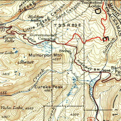
Map from a 1930 winter sports brochure published by the Forest Service (Mt. Hood Cultural Center and Museum)
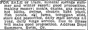
On May 8, 1927, Boyd Summers’ personal cabin at the resort burned down. By the end of the summer of 1929 he had put the resort up for sale due to illness. This notice appeared in the August 30, 1929 edition of the Oregonian:
On November 19, 1929 the Oregonian ran a short announcement that Ray L. Law and his brother Lewis M. Law had purchased the resort. The Law brothers apparently didn’t like running a mountain resort because on January 14, 1930, the day after a Cascade Ski Club tournament at the resort, the brothers took everything they could carry and skipped town. They had never paid Summers a dime.
In 1931 the resort was purchased by Edward J. Wonder from southern California. An article in January of 1932 reported that Wonder planned to make improvements to the resort, including installing lights along the trail that led to Swim from Government Camp as well as along the ski run and toboggan slide, putting in a hydroelectric plant, installing two fish ponds, and building a new main lodge.
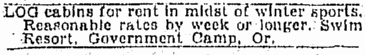
It’s unclear if these plans ever came to fruition. The Swim post office was decomissioned in 1932, probably because a new post office had just been established in nearby Government Camp in 1931. An Oregonian ad in 1935 indicated that the resort was still open for business.
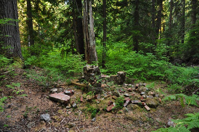
What happened after that is unknown, but at some point the resort closed and the buildings were torn down. Swim is shown on the 1938 Mt. Hood National Forest map, but not on the 1946 map. Henderson writes, “as the Depression deepened, the resort at Swim closed, and the swimming pool became part of a Forest Service campground.” The location of the Swim site today is near the Still Creek Campground in the middle of the forest. The passage of 70 years has almost entirely erased evidence that the resort ever existed. On a recent visit all I found was a pile of bricks on the east bank of Still Creek that were probably part of a fireplace.
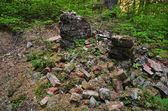
10/13/12 Update: I returned to the area today. You can see more of the ruins by driving into the Still Creek Campground and parking at a small turn-out for a picnic area and exploring the area just beyond.
What appears to be an old hearth surrounded by stones from a collapsed chimney, possibly from one of the cabins
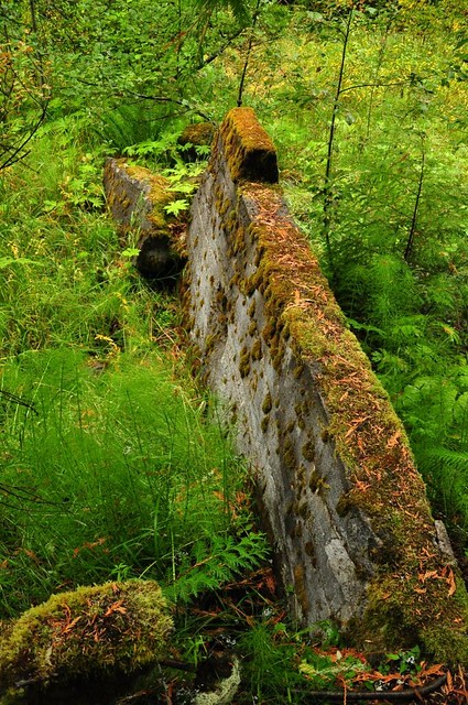
The crumbling concrete walls of the old swimming pool
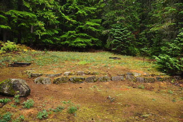
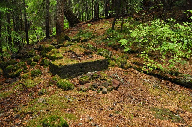
This is right next to the old pool, so it might possibly the stone foundation of the bath house
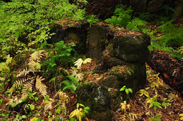
This looks like it might have been a fireplace
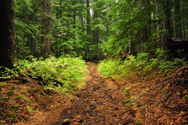
If you walk up the trail from the picnic area you’ll be on the old Barlow Road where emigrants traveled with their wagons in the 1800s and where people walked down from Government Camp in the 1920s and 1930s on their way to Swim
The former location of Swim:
View Larger Map